http://cngodles.xanga.com/711361797/our-wyoming-vacation-2009/
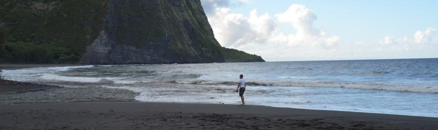
 So here we are, staying 8 nights in the least populated state. Alaska, Hawaii, and Rhode Island have more people. Rhode Island has twice as many people. Washington DC does also. Tonight is our 6th night here. We are staying in Casper, the 2nd most populated town at just shy of 50,000 people. There is Casper mountain to the South, and bland plains to the North.
So what do I think? Both of us? WE LOVE IT! It's been a fun week, that is for sure. Most of the people are very friendly. Lots of people own trucks. Lots of the roads are dirt. The main roads let you go 65, which is a single lane highway across the high plains. So a 100 mile trip takes you under 90 minutes. We have seen many Oregon Trail landmarks. Independence Rock, Trail Ruts, and other important landmarks.
Monday
Monday morning we entered Wyoming from the South. Interstate 25 lets you go 75mph, which is an average of 80 for me. We shot through Cheyenne without stopping. We took the exit for US 26 East to see three Oregon Trail landmarks. Original trail ruts, Register Cliff, and Fort Laramie. They were all very interesting. This was what I thought was the most dry part of the state we saw. The plains were very tan. We stopped in Glendo to look at land that we have been interested in buying for a really long time. We got there, via a long road loop where we got stopped by a cow herd in the middle of the road. 5 miles on a gravel road and we were there. It looked beautiful, but it was probably too remote. The nearest hospital probably miles and miles away.

The open road headed to Fort Laramie after getting off of I-25, a road with a 75MPH speed limit. This road was still 65MPH.

Original Oregon Trail Ruts. Worn into the hill by thousands of passing wagons.

G.O. Willard was here, in 1855. This is a closeup of Register Cliff, which is not far away from the ruts.

Fort Laramie, lots of ruins and lots of restored buildings made up to look like they did 100 years age and longer.

A sign telling you what people live down the gravel road ahead. We looked at property back that way, we liked it, but it was a bit expensive at $50,000+ just for the land.

Glendo Reservoir. One of 12 State Parks in Wyoming.
We arrived Monday night as it was getting dark. We ate dinner at the North Platte Restaurant at which would be our 1st dinner of many there. We ate there 7 out of the 8 nights we were there. It was a friendly restaurant that seemed like it was an old Denny's turned into a family restaurant.
Tuesday
Today the main focus was seeing Independence Rock and Devil's Gate. From Devil's Gate, you could also see Split Rock, another landmark. Martin's Cove is a nearby landmark that was the site of a brutal October Blizzard that killed many Mormon Handcart travelers. They set out on their journey to Zion in Utah a bit too late in the year, and got caught in bad weather before arrival.

The endless highway on our way to Independence Rock. It's a 53 mile drive of mostly this. I think it's beautiful, some people might disagree. No trees like Pennsylvania. This is Wyoming Route 220.

Independence Rock. This is a landmark that travelers on the Oregon Trail tried to reach by July 4th, so that they could guarantee a finish before Winter set in. There are names written into the base and top of the rock. You can climb it, I did...

It was really hard to do. Your already a mile high above sea level. And it's a 130 feet climb. Plus the air is dry, I had cotton mouth by the time I reached the top. And at the top, the winds were strong enough that I thought I was going to lose my glasses.

This is Devil's Gate down the road a few miles. You can see it from the rock. The Indians that lived here believed the devil caused weird happening within the small river valley that cuts the rock. There is a Mormon handcart museum nearby staffed by lots of Friendly Mormons. They don't try to sell you on their religion either, they just give you all of the history. But they are really all up in your face, it's hard to "just look".

This is the highway rest stop that also serves as an entrance to see the rock. As you can see, I took pictures on the rock.

And some HDR's as well.
Wednesday
We wanted to see the town of Douglas and Glenrock, so we headed that way Wednesday. Ayers Natural Bridge State Park was on the way, so we stopped on our way back. We found one antique store in Douglas, and that was it. We walked into this house, looked all around, and left before the older lady out back even noticed we where there. She was chatting away with someone.
Glenrock, WY has a cool dinosaur museum, where you even get to go into a room where they prepare the fossils that are sent it. A bunch of older ladies come in to volunteer their time once a week. They have a few large displays in their showroom as well.

This large natural bridge formation is the result of the river changing course and undercutting this stone. You can also climb on top of the bridge.

Of course I did!
Thursday
This was our big trip day. We were going to at the very least see Thermopolis. The ride starts out slowly, with a 98 mile jaunt to the little town of Shoshone, Wyoming. There is one interesting pit stop along the way in the form of Hell's Half Acre (It's way more than an acre). These are badlands that appear in the middle of nowhere along the trip on US 20/26. The movie Starship Troopers was filmed here as well. The store is all borded up, seeing they probably did not get that many visitors. We were the only ones there at the time. But it was beautiful!


Once you reach Shoshone, you take US 20/WY 789 North past Boysen State park and into the Wind River Canyon. Ever since we got to Wyoming, it's been pretty flat. Lots of mountain ranges, but they always seem to be in the distance, 10 or more miles away. The canyon was completely different. It starts out going through 3 rock cut tunnels then opens up into a canyon with really high walls. The Wind River is a large enough attraction. Halfway up there was a little store that sold all sorts of fire crackers, knick knacks, and drinks. We both stopped to get something to drink, and the lady let us feed her fish. They were huge trout, not Koi as we expected.

The road past Boysen.

Wind River Canyon.
Thermopolis
This town was a unique Wyoming stop. The town is home to the world's largest hot springs. There is a state bath house located on the side as well as a Buffalo pasture. The hot springs stinks really bad, as a sulfer smell overwhelms you when you get really close. The primary minerals are sulfer and calcium. People believed the water could heal you, so the US Government bought 10 acres of land from the local Indians for a sum of 60,000 (I'm pretty sure). It is now Hot Springs State Park.

This is one of the Springs. Being this close, all you could smell was the sulfer, very sickening.

The buffalo pasture. No fences between you and the buffalo here. You had to wait for them to get off the road. They are as big as your car, so you don't yell at them.

This is a fountain that was made by the park. I say made because they used a pipe to create a fountain from the hot spring water. This caused the flow to turn hard, being mineral water, and over decades formed this dome.
Back to Shoshone, onwards to Riverton and Lander.
From Shoshone to past Riverton is an Indian Reservation. There are Indian casinos here, because they are on this land. Riverton has one of the 10 Walmarts in the entire state. And 2 of the 3 that are in the Central part of the state. The other 2 are in Capser, the only city to have more than one.
Lander is a town at the foot of a mountain range and Shoshone National Forest. It's a town that I wouldn't mind living in. We went to Sink's Canyon State park, which I'll talk about later, and up the switchbacks to the top of the mountain. It was getting dark, and since we were going to come back, we headed home.

Lander, Wyoming

The view from the top of the hill/mountain.

HDR shot from what is called Beaver Rim. The mountains are called the Wind River Range, a Rocky Mountain chain that boasts 53 granite peaks over 13,000 feet high.
We hurried home and arrived there just as it got dark. We needed gas in a small town called "Wind Gap". Gas was over $3.00 a gallon, as they knew they were the only game in at least 50 miles in each direction.
 Friday
After a long Thursday, we decided to take a break and only see one major attraction. The National Historic Trails Interpretive Center in Casper. This is done by the National Park Service and is dedicated to teaching the history of the 4 major trails. The Oregon Trail, The California Trail, The Mormon Trail, and The Pony Express. The center had to have cost big bucks. Everything was big, nicely done, and there were many interactive things to do. It cost $3 a person to get in.

The entrance to the center. It was a VERY well designed building, probably some famous architect.

The view towards Casper from the center. Casper Mountain is in the background. It looks like a little hill, but it's actually a huge mountain.
Saturday
Saturday was the big day. Lots of driving planned, and probably the last big big trip of the vacation. We started out by driving to Hudson, Wyoming, where Rachel has her eye on a Pronghorn Antelope head mount. That was 135 miles to start the way. Past Hell's Half Acre, past Shoshone, through Riverton, and into Hudson, about the biggest town between Riverton and Lander.
After leaving there we headed back to Sinks Canyon State Park and onwards to the Shoshone National Forest. The middle fork of the Popo Agie River does a strange thing in this state park. It disappears underground and comes back up a mile down the road. It's an active geological formation, so it changes from year to year. Alot of sand is brought up from underground creating a sand bar at the "rise" park of the river. The part where it dissapears is called "The Sinks".

The Rise of the Popo Agie.

Sinks Canyon to start the trip through the mountains. Similar to the Wind River Canyon.

Mountain Peaks from the top of a rise. This is Route 131 that cuts through the forest. This part was paved, but that didn't last long.

A view from Frye Lake.

The little Pope Agie River.

A view looking North towards one of the last few bends in the road. Rachel had a hard time keeping her eyes open in the sun.

A look back at a red soil landscape viewed going down the road through "The South Pass" on Wyoming Route 28. Called Red Canyon.

Long stretches looking ahead on the long trip home. Everything in Wyoming is like 100 miles away. :)
Sunday
Not much, a few stores. Spent alot of time indoors.
Monday
Drove up Casper Mountain, then spent the rest of the day indoors besides dinner.
Tuesday
Work up to drive to see my brother in Milford Nebraska. Scenic Trip.
Wednesday
Started home at 1AM after leaving Milford. Made it home shortly after 10PM.
-- CURRENTLY WORKING ON THIS PIECE, ITS GONNA BE BIG --